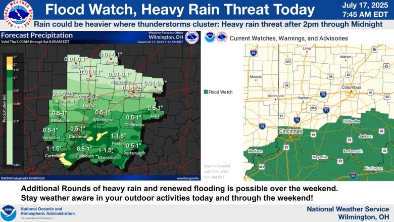
The National Weather Service has issued a flood watch for Boone, Kenton and Campbell Counties from 2 p.m.
Thursday afternoon to midnight
.
The stories all of NKY will be talking about, delivered to your inbox each weekday morning.
Additional heavy rain throughout the rest of the week and over the weekend could also lead to the possibility of flash flooding in the region.
Thunderstorms, some with heavy rain, are likely today through Friday… especially south of Interstate 70.
pic.twitter.com/0K2DXJS14s
— NWS Wilmington OH (@NWSILN)
July 17, 2025
You can view the precipitation radar below or at the
National Weather Service’s dedicated radar page
.
Stay up to date with announcements and warnings at
weather.gov
or at the
National Weather Service’s X page
.
Refresh the page for up-to-date radar results.
Liked this story? Help make the next one possible.
Independent local news doesn’t happen without community support. Your monthly donation helps us keep covering the people, issues, and places that make Northern Kentucky what it is.
When you give, you’re not just supporting one story — you’re investing in all the ones still to come.
SUPPORT LOCAL NEWS