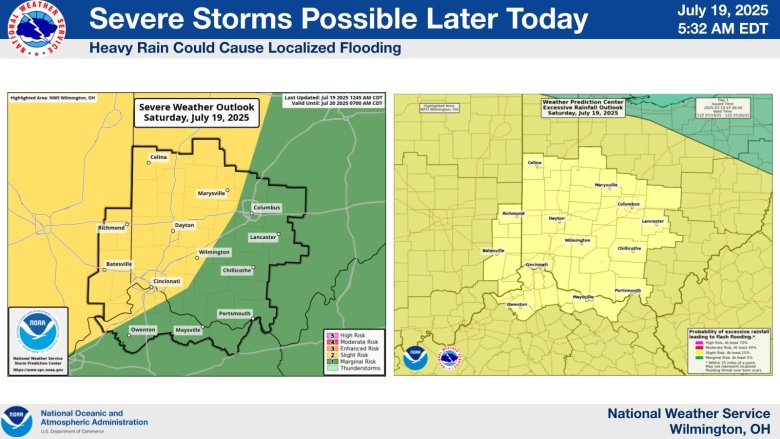
The National Weather Service has indicated the possibility of severe weather in Boone, Kenton and Campbell Counties for Saturday and Sunday.
The stories all of NKY will be talking about, delivered to your inbox each weekday morning.
“Severe weather is possible [Saturday] with damaging winds the primary threat,” according to
an outlook statement from the National Weather Service
. “There is also the threat of heavy rain which could lead to flash flooding.”
Saturday’s forecast calls for cloudy skies in the morning followed by scattered showers and thunderstorms in the late afternoon, some of them being severe.
Similar weather is possible on Sunday. The forecast calls for showers in the morning, then cloudy in the afternoon. The potential for heavy rainfall is there.
You can view the precipitation radar below or at the
National Weather Service’s dedicated radar page
.
Stay up to date with announcements and warnings at
weather.gov
or at the
National Weather Service’s X page
.
Refresh the page for up-to-date radar results.
Liked this story? Help make the next one possible.
Independent local news doesn’t happen without community support. Your monthly donation helps us keep covering the people, issues, and places that make Northern Kentucky what it is.
When you give, you’re not just supporting one story — you’re investing in all the ones still to come.
SUPPORT LOCAL NEWS